


Exact checkpoint
The selected model is nvidia/segformer-b0-finetuned-ade-512-512 at revision 489d5cd81a0b59fab9b7ea758d3548ebe99677da. It uses the B0 architecture, ImageNet pretraining and ADE20K fine-tuning at 512 by 512 pixels. This is a semantic segmentation checkpoint, not an instance-separation model.
How it works
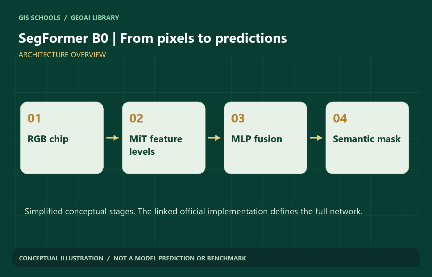
The hierarchical Mix Transformer encoder gathers detail and context at multiple resolutions. A lightweight MLP decoder combines those features into per-class pixel scores. Semantic segmentation chooses a class for each pixel; neighboring objects of the same class are not automatically given different instance IDs.
Typical input and output
Input: three-channel RGB imagery processed with the official image processor. This checkpoint is documented for 512 by 512 fine-tuning. Output: semantic class logits, resized to the target image dimensions and converted to a label mask. Preserve the supplied id2label mapping; ADE20K label reduction and ignored pixels need explicit handling when adapting a dataset.
Why consider this model
The multi-scale encoder combines broad scene context with local information. The lightweight decoder makes B0 a useful architecture to study before larger variants. The official model card and Transformers API make the exact checkpoint and preprocessing discoverable.
GIS and remote-sensing workflow
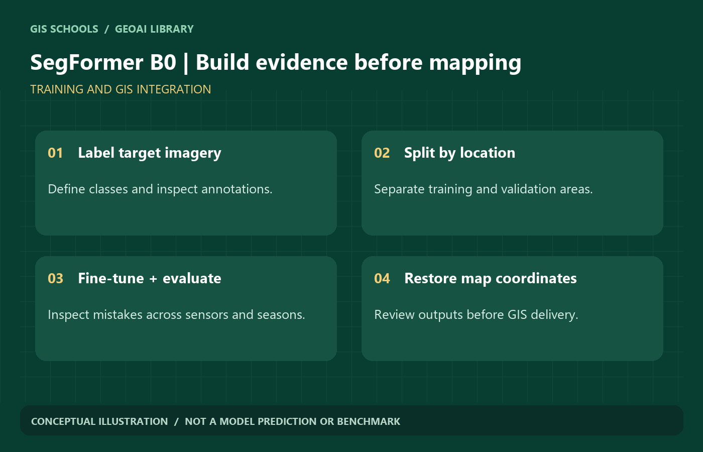
After suitable fine-tuning, semantic segmentation can support building, road, vegetation, water or construction-area mapping. These are target applications, not verified capabilities of the supplied weights. Keep masks on a known raster grid, restore the original spatial transform, and check class semantics before polygonizing. A pixel mask alone is not a surveyed boundary.
Limitations
ADE20K scene categories do not validate remote-sensing land-cover performance. Ground-level buildings or vegetation in a scene dataset are different from overhead mapping classes. Fine boundaries, small roofs and thin roads may be lost. The supplied license restricts use to non-commercial research or evaluation.
Training and fine-tuning
Create image and integer-mask pairs with the same grid, using an explicit class-ID table and an ignore value for unlabeled pixels. Replace the semantic head for your target labels and fine-tune rather than treating ADE20K IDs as your GIS legend. Keep image and mask transforms aligned; resize categorical masks with nearest-neighbor sampling. Check the processor do_reduce_labels setting against your own background convention.
Framework and hardware
PyTorch and Hugging Face Transformers, with the original NVlabs implementation also linked. A GPU is useful for training. CPU inference is possible for a limited experiment, but latency and RAM should be measured on the actual chip size. No fixed hardware minimum or measured GIS accuracy is supplied.
Model files and license
Official external weights are used. The NVIDIA license permits redistribution subject to notices but limits intended use to non-commercial research/evaluation. GISSchools commercial or monetized distribution status has not been established, so no local mirror is asserted to comply. Obtain appropriate permission before commercial use.
Practical validation before mapping
- Split by geographic area before creating overlapping chips; keep the final test area out of model selection.
- Inspect different seasons, shadows, sensors and object sizes. Review errors on the original imagery, not only a single aggregate score.
- Use per-class IoU, confusion matrices and boundary inspection. Keep uncertain outputs for human review.
- Record data rights, coordinate reference system, pixel size, preprocessing and model revision with exported results.
Validation status: GISSchools has checked source provenance and website delivery. No training, inference benchmark or remote-sensing accuracy evaluation was performed for these pages. Gallery diagrams are conceptual illustrations, not model predictions.
Official references
Examples and images
Downloads and resources
Official external weights are used. The NVIDIA license permits redistribution subject to notices but limits intended use to non-commercial research/evaluation. GISSchools commercial or monetized distribution status has not been established, so no local mirror is asserted to comply. Obtain appropriate permission before commercial use.
Original implementation and project updates.
Loading, preprocessing and usage reference.
Review the terms before using or redistributing the model.
Comments
No comments yet. Start the discussion.
Leave a reply
Your email address will not be published. Required fields are marked.